ESRL Helps Detect & Monitor Storms Leading to Dangerous Debris Flows
As the wet season begins in the Western U.S., one of the consequences of the enormous wildfires that occurred in California this past summer is the possibility for devastating debris flows to occur, which makes the impacts of wildfires a year-round problem. Of major concern to residents along the central California coast is the massive burn area associated with the Basin and Indian wildfires. The NOAA Earth System Research Laboratory (ESRL) responded very rapidly to a request from Dave Reynolds, Meteorologist-in-Charge at the National Weather Service's San Francisco/Monterey Weather Forecast Office (SFO) to operate several state-of-the-art research instruments at Pt. Sur, California. Beginning in November, ESRL will provide atmospheric measurements of land-falling winter storms upstream of the burn area. Once the instruments and satellite communications are installed, the data will begin flowing into the forecast office via the web. SFO will even dedicate one of their officeŐs three 32 inch flat panel displays to monitor the special observations provided by ESRL.
The USGS is responsible for studying the soil characteristics and types of debris remaining after the fire season to gauge the possibility for debris flows. They used a model to calculate the probability of debris-flow production from individual drainage basins within the burn area in response to a given storm event. For a moderately intense 3-hour rainfall (1.9 inches), USGS estimates that all but 45 of the 859 basins examined would produce a debris flow at least 80% of the time. In addition, calculated debris-flow volumes ranged between 114 and 126,000 cubic meters in response to the same short-term storm accumulation. Debris-flow volumes greater than 10,000 cubic meters were calculated for 152 of the 829 basins. Debris flows within this range of volumes pose significant hazards to life and property.
Due partly to steep terrain, operational radar coverage in the central California coastal region is quite poor. There is serious concern among forecasters that much of the shallow rain clouds caused by moist airflow up the coastal mountain slopes could go undetected by the radar network. In addition, the radar bright band that results from the melting of ice particles as they descend through the atmosphere will likely exist in the lowest beam of the closest operational radar. The bright band causes the operational radar rainfall algorithm to produce erroneous results. With the addition of ESRL's research instrumentation, the NWS will be able to issue more accurate warnings to help mitigate impacts from flooding and debris flows.
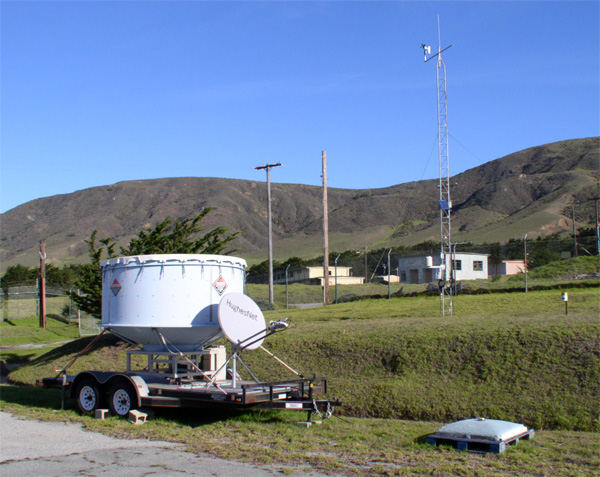
Photo: Instrumentation at Pt. Sur including (foreground) S-Band Radar and Disdrometer, and (background) Meteorological Tower. By Clark King, NOAA.