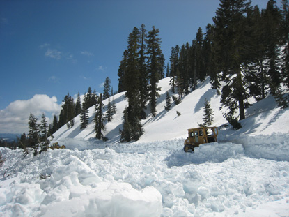
Photo by Todd Hisaichi, NPS
|
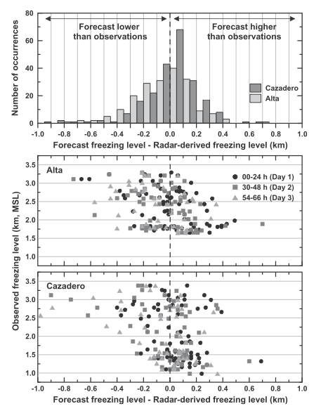
Figure 6 from paper: (top) Frequency of occurrence of freezing-level forecast bias for all heights and
forecast verification times. The bias distribution, as a function of observed (i.e., radar derived)
freezing level and forecast verification time are shown for (middle) Alta and (bottom) Cazadero.
|
HMT Publication Notice
A journal article entitled Developing a Performance Measure for Snow-Level Forecasts, by Allen B. White, Daniel J. Gottas, Arthur F. Henkel, Paul J. Neiman, F. Martin Ralph, and Seth I. Gutman appeared in June 2010 issue of Journal of Hydrometeorology, 11, 739-753, doi:10.1175/2009JHM1181.1.
In regions of elevated complex terrain along the west coast of the US, snow level is an important meteorological factor for water resource management and flood forecasting. While the current state of forecasting technology provides a significant amount of spatial and temporal guidance for snow level, very little is quantifiably known about the accuracy and biases of these forecasts, particularly across the highly variable terrain of the Sierra Nevada. By deploying surface-based vertically pointing radars in and around these regions of complex terrain and by utilizing a recently developed snow-level detection algorithm, NOAA/ESRL/PSD collaborated with the California Nevada River Forecast Center (CNRFC) to perform the first verification study of locally produced, operational snow-level forecasts. The findings include identification of forecast biases and hydrologically significant forecast errors associated with heavy precipitation events. Future work and applications include developing real-time model bias corrections and real-time performance measure tools for operational forecasters and water resource managers. This work has been sponsored by HMT and is a part of HMT's Snow Information major activity area.