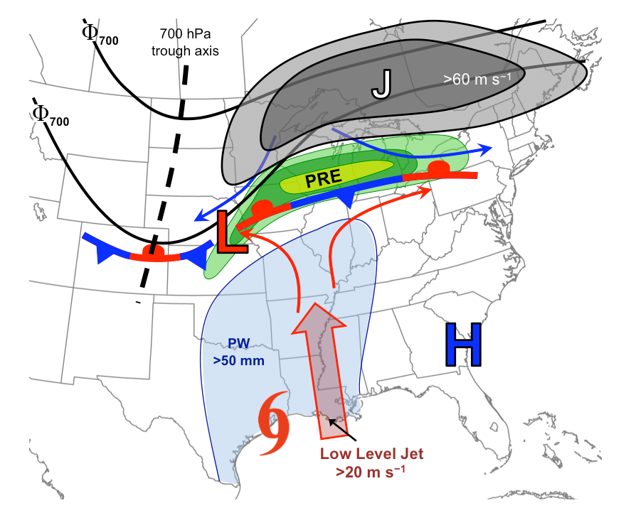
Meteorological features associated with a PRE ahead of a tropical cyclone:
1) downstream 200-hPa jet ("J"; gray shading), 2) upstream 700 hPa trough
axis (dashed black line) and height contours (black), 3) low-level jet
(large arrow), 4) tropical moisture plume (light blue shading representing
precipitable water values > 50 mm) emanating from the tropical cyclone:
(red conventional tropical cyclone: symbol), 5) surface frontal boundary,
6) low-level wind pattern near the frontal boundary and PRE in the warm
(red-arrowed lines) and cool (blue-arrowed lines) air, and 7) surface
cyclone and anticyclone locations given by the red "L" and blue "H"
symbols, respectively. Figure from Bosart et al. (2010).