NOAA and NASA Collaborate on Field Projects in North Carolina
May 23, 2014
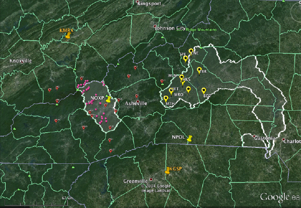
NOAA and NASA are teaming up to study precipitation and hydrologic processes in the western North Carolina region. NOAA's Earth System Research Laboratory (ESRL) has placed instruments in the upper Catawba watershed (east of Asheville) as part of HMT-SEPS to learn more about orographic precipitation processes and hydrologic impacts in this region. NASA has instrumented the Pigeon watershed (west of Asheville) as part of the Integrated Precipitation and Hydrology Experiment (IPHEX) to improve satellite retrieval algorithms of precipitation in complex terrain. The two watersheds were selected in order to better understand the evolution of precipitation across the higher terrain of the Pigeon to lower terrain in the upper Catawba.
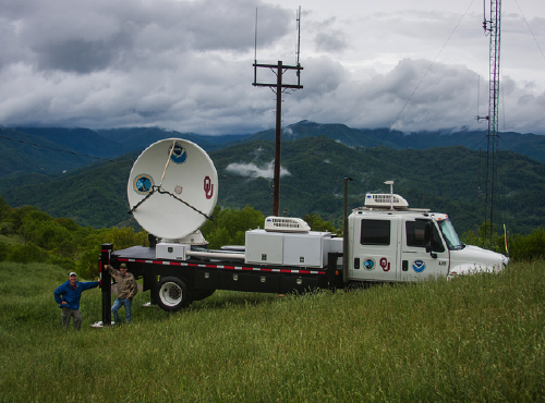
In addition to autonomous surface meteorology and profiler sites in the upper Catawba, the NOAA National Severe Storms Laboratory (NSSL) has deployed a mobile X-band radar (NOXP) in the Pigeon to study orographic rainfall processes during IPHEX and to complement the profiling instrumentation in the upper Catawba. ESRL is also partnering with NC State University to conduct daily forecasting exercises during IPHEX and analyze QPF errors in HMT-SEPS extreme precipitation events. In addition, ESRL is supporting UNC – Asheville to perform special weather balloon/sonde launches during IPHEX.
During the week of May 12th, ESRL and NSSL scientists teamed up to collect data NOXP data, visit the local Weather Forecast Office in Greenville-Spartanburg, and to participate in the IPHEX daily operations. The NSSL NOXP will be collecting data from May 1st - mid June, 2014 and the ESRL instrumentation in the upper Catawba will remain in place through early October 2014.
Contact: Rob Cifelli