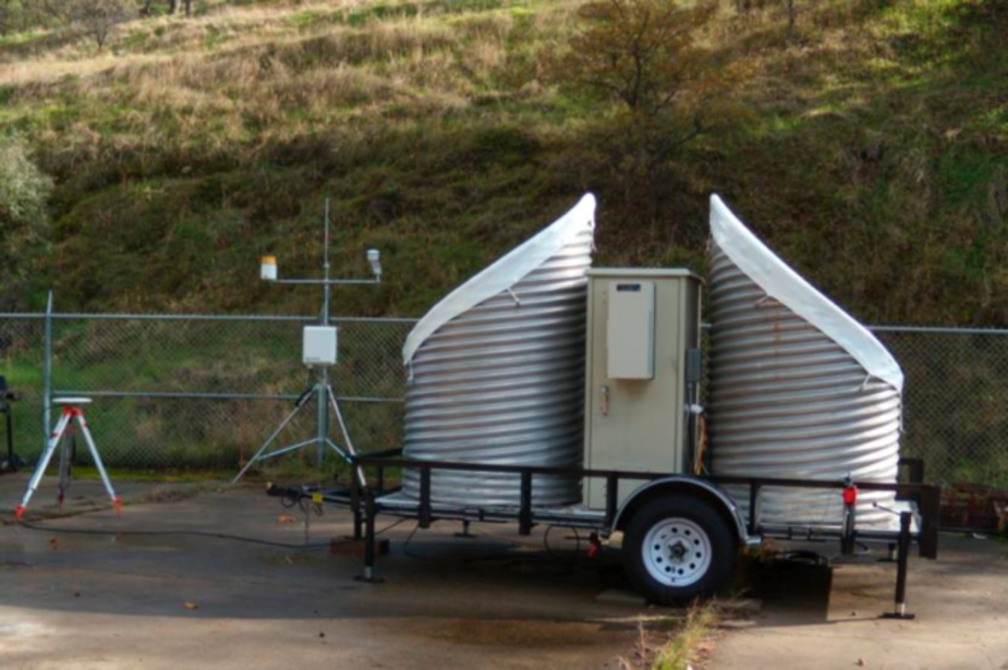
Figure 1. The new snow-level radar at Pine Flat Dam
|

Figure 2. Example real-time image from the snow level radar
|
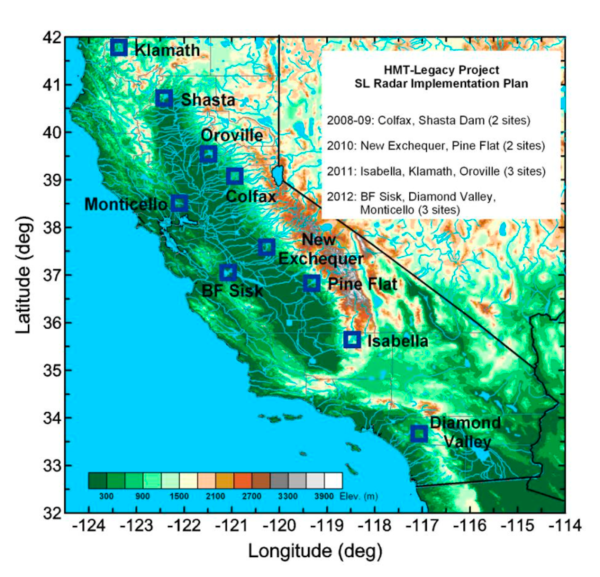
Figure 3. Current and planned deployments of snow-level radars at major watersheds across the State of California
|
New Network of Snow-level Radars Deployed in California
The snow-level radar utilizes modernized frequency-modulated, continuous wave (FM-CW) technology, which only uses less than a watt of transmitted power. This dramatically reduces the price of the radar components. The snow-level radar can be built for approximately 1/10th of the price of one of the current state-of-the-art pulsed radars used for the same purpose. The radar operates at 2.835 GHz, which is ideal for measuring the properties of precipitation because at this frequency there is very little weakening of the radar signals by precipitation. Snow-level detection (Fig. 2) is based on an automated algorithm1 developed by CIRES and ESRL scientists.
A five-year agreement with CA-DWR calls for ten snow-level radars to be deployed in key watersheds across the state. Four of these radars have already been deployed at or near major California reservoir dams: Shasta Dam, Colfax (above Folsom Dam), New Exchequer Dam, and Pine Flat Dam. Figure 3 shows where these radars are located along with the deployment plan for the six remaining radars. The radars are part of an unprecedented observing network that will provide critical information on the forcings of extreme precipitation and flooding, as well as long-term climate observations to help decision makers adapt to a changing climate.
Related Publications:
White, Allen B., Daniel J. Gottas, Eric T. Strem, F. Martin Ralph, Paul J. Neiman, 2002: An automated brightband height detection algorithm for use with Doppler radar spectral moments. J. Atmos. Oceanic Technol., 19, 687-697.
White, A., B., D. J. Gottas, A. F. Henkel, P. J. Neiman, F. M. Ralph, S. I. Gutman, 2010: Developing a performance measure for snow-level forecasts. J. Hydrometeor., 11, 739-753.