Radars installed at the DOE SGP site near Ponca City, Oklahoma, in support of the MC3E field campaign
|
MC3E Starts with Severe Weather over Oklahoma
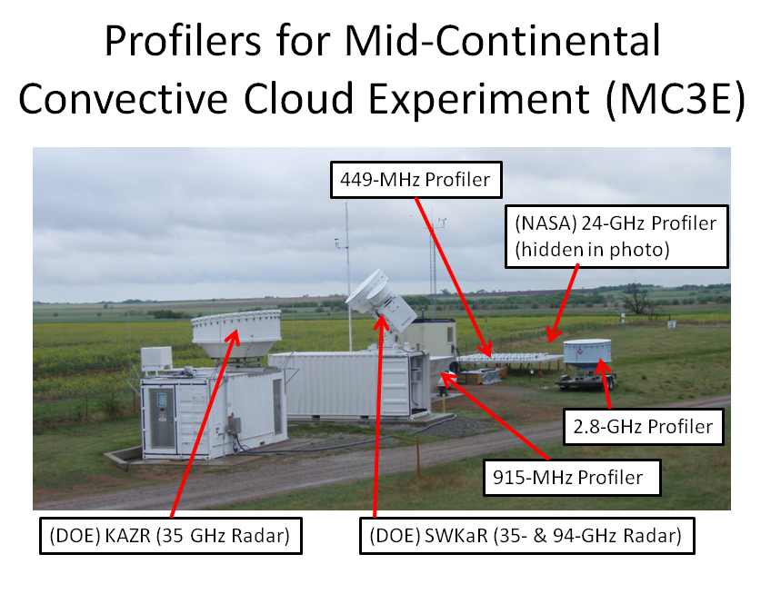
PSD engineers (Scott Abbott, Tom Ayers, Clark King, and Jesse Leach) deployed a 449-MHz wind profiler and a 2.8-GHz precipitation profiler at the DOE Southern Great Plains (SGP) field site near Ponca City, Oklahoma. Both radars are pointed vertically to sample the vertical structure of precipitation that passes overhead. The 449-MHz profiler will provide observations of the vertical air motion and the 2.8-GHz profiler will observe the hydrometeor motion – raindrops, hail, and ice particles being lifted and pushed downward by the vertical air motion. By combining these two observations the number and size of raindrops can be estimated in the vertical column which provides information on the microphysical processes occurring in the cloud systems. Deploying the 449-MHz and 2.8-GHz profilers is a prototype configuration for future NOAA Hydrometeor Testbed (HMT) deployments focusing on quantifying precipitation estimates (QPE) in complex terrain.
The ESRL profilers are just two of six radars operating at the SGP site and includes the frequencies: 449 MHz, 915 MHz, 2.8 GHz, 24 GHz, 25 GHz, and 94 GHz.
"This is the first time that six different frequency radars have ever operated at the same location to study precipitation," said Dr. Christopher Williams, CIRES Research Scientist with PSD and a member of the NASA PMM Science Team. "This six-frequency radar site is an exciting advancement in observing precipitation because we'll be able to exploit the benefits and minimize the limitations of each operating frequency as they observe the same column of precipitation."
The MC3E field campaign continues through 6 June with the six radars at the SGP site, nine scanning polarimetric radars overlooking the SGP site, two aircraft (the NASA ER2 and the University of North Dakota Citation) flying over the SGP site, and balloon launches from 5 locations around the SGP every 3 hours during rain events. Progress can be monitored at the web site: http://mc3e.nsstc.nasa.gov.