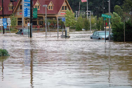
Flood in Asheville, NC, Sep. 2004. Photo credit: FEMA |
More Images: |
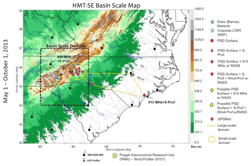
Location of regional instrumentation planned for HMT-SE
|
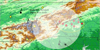
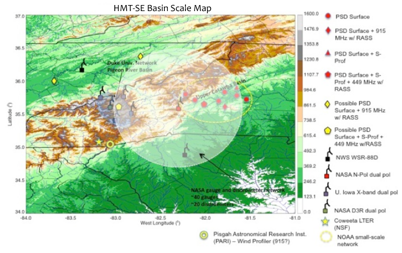
Location of basin-scale instrumentation planned for HMT-SE
|
Click image for more detail |
|
|
|
May 27, 2011
HMT-Southeast Planning Underway
HMT investigators met last month in Huntsville, AL with NASA
representatives and researchers from Duke University and the University of
Iowa to discuss plans for an HMT-Southeast "pilot study" (referred to as
HMT-SE), to be deployed in western North Carolina during May-October 2013.
HMT-SE will focus on quantitative precipitation estimation (QPE) and will
complement a similar effort by NASA to validate precipitation retrieval
algorithms from the Global Precipitation Measurement (GPM) satellite
constellation in the same region of North Carolina. The NASA field
campaign is referred to as the GPM Convective and Orographic Precipitation
and Hydrology Experiment (COPrHEx). In fact, NASA's motivation for leading
a validation campaign in the Southeast is driven primarily by the desire to
partner with NOAA HMT in precipitation research activities. In turn,
HMT-SE turned its focus to western North Carolina to better leverage NASA's
on-going ground validation (GV) activities in an area of orographic terrain
where an existing network of ground-based sensors currently exists and
where NASA scanning radars and a dense array of disdrometers are likely to
be deployed. These multi-agency data sets will aid NOAA HMT research on
QPE. HMT-SE—COPrHEx will involve NASA, NOAA, and academic partners.
NOAA plans to bring a number of instrument assets to the campaign
including:
- 6 profiling radars (including 449 MHz and 915 MHz radars for wind profiling and S-Prof radars for profiling precipitation vertical structure);
- 6 surface sites with standard meteorology sensors (temperature, relative humidity, pressure, wind, and redundant precipitation measurements) as well as soil moisture (5-levels); and
- 2 additional sites with GPS-met sensors for integrated water vapor measurements. These GPS sites would be collocated with existing 915 MHz profilers (one operational at Charlotte and one at Raleigh that needs repairs)
NOAA will utilize assets from the NASA COPrHEx ground campaign as well as
existing operational and academic institution (Duke University and
University of Iowa) instrumentation. The combined infrastructure will
provide an opportunity to baseline existing QPE systems, improve
algorithms, and test new technologies within HMT's overall QPE Major
Activity Area.