|
|
|
Contact: Rob Cifelli
|
|
HMT Conducts Rainfall Study Over Fourmile Canyon Burn Area
A wildfire in Fourmile Canyon area burned approximately 6,000 acres and more than 160 homes in September 2010. The burned area covers an area of steep terrain immediately west of Boulder and became an area of concern for the National Weather Service and local emergency managers due to the increased vulnerability to flash flooding and debris flows.
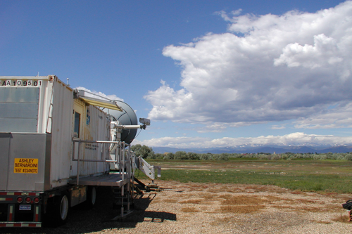
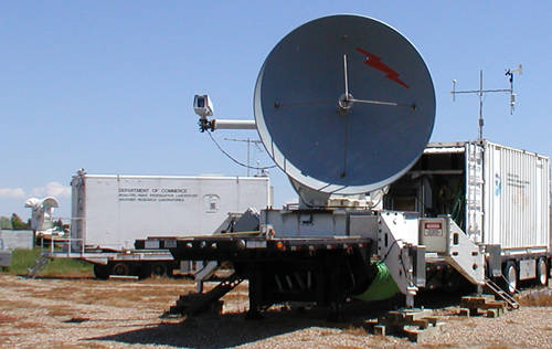
ESRL operated their X-band dual polarimetric radar (HYDROX) from Erie, CO during selected events between June and August 2011. NCAR and the USGS deployed surface instrumentation, including rain gauges, disdrometers, and stream gauges at selected sites. CSU operated their CHILL S-band, dual polarimetric radar.
The combination of radars at varying range from the burn area (CHILL and the nearest NEXRAD – KFTG are more than 70 km distant and HYDROX is approximately 30 km distant) provided a unique opportunity to examine the impact of high-resolution observations on the resulting rainfall totals and spatial patterns, as well as the resulting impact on hydrologic runoff simulations. Specific goals of the "4MileQPE" project included:
- Evaluation of X-band dual-polarization rainfall estimation for warm season convective events in complex (steep) terrain;
- Evaluation of the added benefit of gap-fill radar data to MPE/NMQ Q2 quantitative precipitation estimation (QPE) algorithms in Front Range events;
- Sensitivity of hydrologic model simulations to QPE forcing; and
- Analysis of the Model Evaluation Tools (MET) verification package for QPE validation, in conjunction with HMT-DTC related efforts
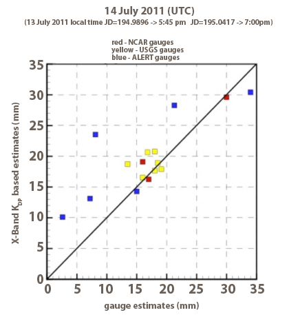
Preliminary results from a flash flood event on July 13-14th showed that the X-band rainfall estimates were in good agreement with corresponding measurements from a network of rain gauges (USGS, NCAR, and ALERT) in the Fourmile Canyon area.