News

Most Recent News Stories and Archive

 |  News

Storm hits California coast as HMT researchers kick off atmospheric river study

February 10, 2014

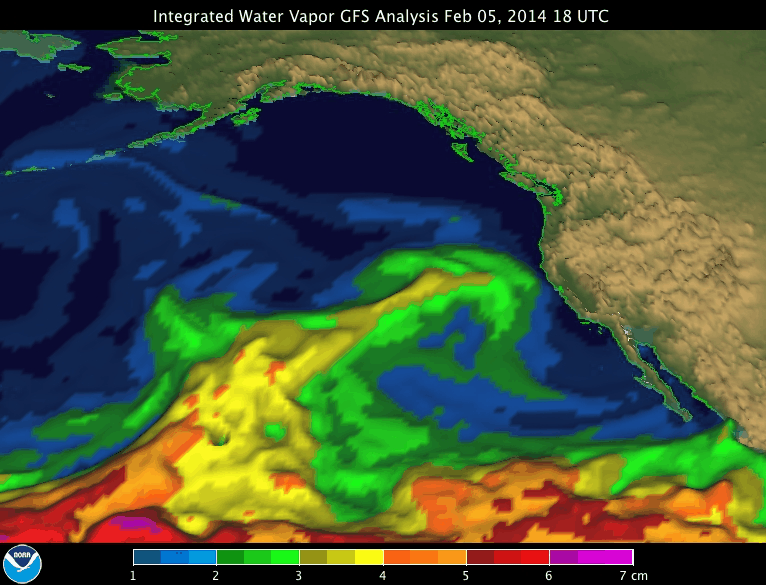
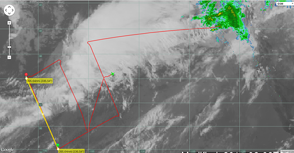
This past weekend, an intense storm caused by an atmospheric river hit the California coast bringing much-needed rain and snow to the northern part of the state. HMT researchers from NOAA's Earth System Research Laboratory and collaborators from Scripps Institute of Oceanography kicked off a study on atmospheric rivers, releasing 52 dropsondes over the Pacific Ocean during two successful research flights on Friday and Saturday.

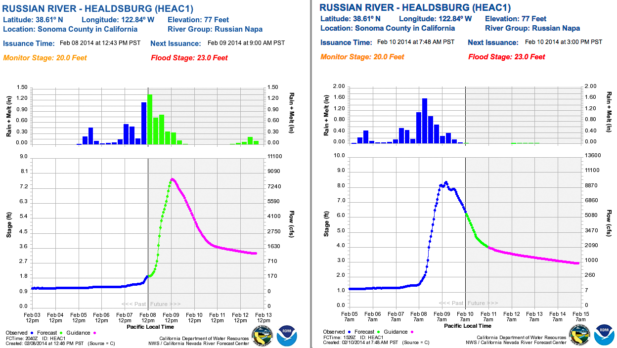
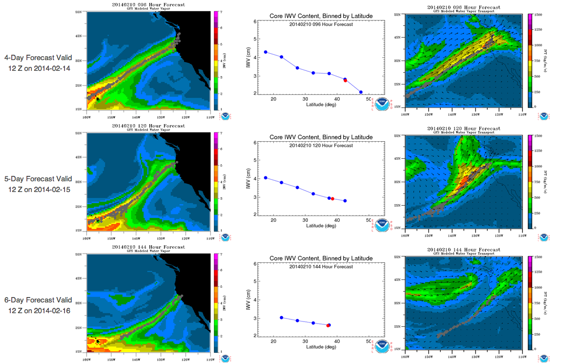
More than five feet of snow fell in the Sierra Nevada Mountains, and as much as 12 inches of rain fell at lower elevations. The Russian River, north of San Francisco, went from a trickle to flowing more than 9,000 cubic feet per second within a 24 hour period. Forecasters anticipate another atmospheric river, focusing more on the Oregon and Washington coasts, will hit later this week.

Contact: Allen White

Related Links

Click Images for More Details
Animation of atmospheric river event, February 2014. (CREDIT: NOAA/ESRL Physical Sciences Division)
Flight path of NOAA Gulfstream IV research aircraft for this deployment
Russian River in Sonoma County responds to the heavy precipitation event. Measured streamflow at Healdsburg goes from a trickle to more than 9000 cfs. in 24 hrs. (Image courtesy: NOAA/CNRFC)
PSD's Atmospheric River Forecast Detection Tool suggests more precipitation is on its way to the West Coast.  Left side is integrated water vapor, right side is integrated water vapor transport.  Red dot shows the latitude where core of AR makes landfall.
PSD's Atmospheric River Forecast Detection Tool suggests more precipitation is on its way to the West Coast. Left side is integrated water vapor, right side is integrated water vapor transport. Red dot shows the latitude where core of AR makes landfall.