
Ross Dam, WA, Credit: USACE |
|
| Related Figure: | |
|
|
Click image for more detail |
|
|
Contact: Paul Neiman
|
|
HMT Publication Notice:
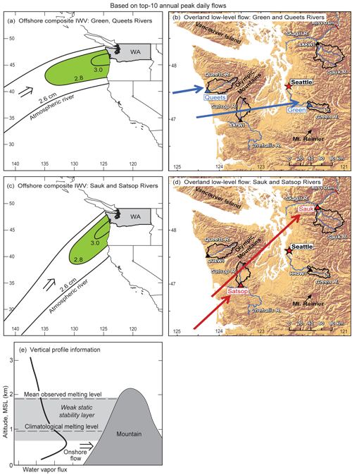
As part of an ongoing research effort associated with HMT activities focused in the Pacific Northwest, this paper utilizes multi-decadal streamflow observations from four large watersheds in western Washington in conjunction with polar-orbiting SSM/I satellite imagery and the 32-km resolution North American Regional Reanalysis (NARR) gridded dataset to determine the meteorological conditions most likely to produce the largest annual discharges in those watersheds. The results demonstrate that atmospheric rivers (ARs) are responsible for these large discharges, and that the orientation and low-level flow direction within these ARs dictate which watersheds are most likely to flood. This research was motivated by storm damage incurred at the Howard Hanson Dam, and, subsequently, the dam's reduced capacity to store flood waters, immediately upstream of a major commercial hub (with billion of dollars of infrastructure and commerce) on the south side of Seattle. This work is the product of close cooperation between teams from NOAA/PSD in Boulder, CO and the U.S. Army Corps of Engineers in Seattle, WA.