Study Uses NASA 'A-Train' to Measure Atmospheric River Properties
November 15, 2013
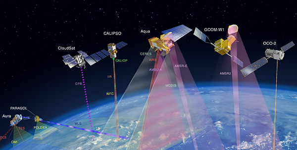
A new study measuring the properties of Atmospheric Rivers (ARs) using the NASA A-Train (several Earth-observing satellites that closely follow one after another along the same orbital track) was published in the November 2013 issue of the Monthly Weather Review. ARs – long, narrow regions of atmospheric water vapor transported from the tropics to midlatitudes – play a crucial role in U.S. West Coast water supply and sometimes cause severe flooding.
In this study, entitled Characteristics of Landfalling Atmospheric Rivers Inferred from Satellite Observations over the Eastern North Pacific Ocean, author Sergey Matrosov (of NOAA/ESRL and CIRES) analyzed 256 individual crossings over ARs by the A-train during three water years (2006-2007, 2007-2008, 2008-2009), which represent different cycles of the El Niño-Southern Oscillation. The result is a more detailed look at the properties that make up ARs.
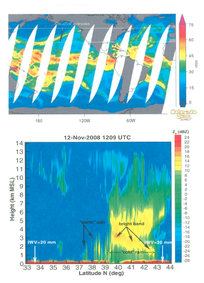
Measurements from the A-Train CloudSat and Aqua satellites were used to simultaneously obtain the vertical structure of rain rate and ice cloud content, as well as the atmospheric water vapor amounts, cloud top heights, type of rainfall, and AR boundaries along the individual crossings. The combination of the active and passive satellite remote sensors allowed for unprecedented observations of the AR formation cross-sections (figure).
The satellite observations provide statistics on the occurrence and rate of rainfall, the widths of ARs and associated rain bands, and other AR properties. The results of the study suggest that there is a significant relationship between ice amounts and the rain rate of certain types of rainfall. The results also show that there is a dependence of AR properties on their latitude and temperatures. Findings from this study could be used for refining and validating models trying to adequately represent ARs over land.
Contact: Sergey Matrosov
Matrosov, Sergey Y., 2013: Characteristics of Landfalling Atmospheric Rivers Inferred from Satellite Observations over the Eastern North Pacific Ocean. Mon. Wea. Rev., 141, 3757-3768. doi:10.1175/MWR-D-12-00324.1

