Study documents the structure and evolution of a February 2014 atmospheric river
May 27, 2016
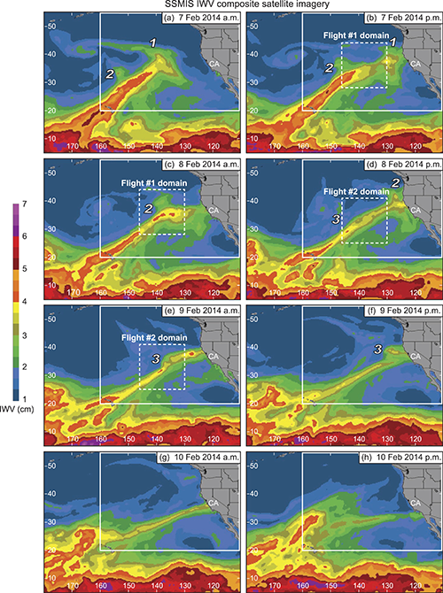
A study by HMT researchers and colleagues led by Paul Neiman of the NOAA Earth System Research Laboratory documents the structure and evolution of a February 2014 atmospheric river (AR) and, in particular, the mesoscale frontal waves that persisted as the AR made landfall. The study took advantage of dropsondes launched from the NOAA G-IV research aircraft during the CalWater2 Early Start project and an extensive network of HMT ground-based instrumentation installed in California. ARs deliver up to 50% of the annual precipitation to the U.S. West Coast and therefore are important from a water resources standpoint, but they can also lead to dangerous flooding. Although this particular AR produced 200-400 mm of precipitation, it did not lead to flooding primarily because of the dry antecedent soil conditions resulting from California’s multi-year drought.
This study is unique in that it is the first study to 1) employ two research flights and multiple full-tropospheric dropsonde cross sections within a single AR to provide novel offshore documentation of the modulation of an AR by transient mesoscale frontal waves, 2) link offshore aircraft analyses with special land-based analyses immediately downwind in order to track these waves and assess their impacts upon landfall, and 3) utilize the newly implemented tail-mounted Doppler radar on the G-IV.
Continued airborne and land-based observations are crucial to improving our understanding of the dynamical and microphysical processes that govern precipitation during AR landfall. This will ultimately lead to better forecasts—including timing, duration, and location—for AR-related precipitation.
Contact: Paul Neiman