Atmospheric River Observatory at Point Sur California Now Operational
January 27, 2017
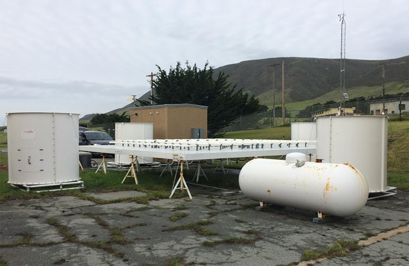
HMT engineers from the NOAA ESRL Physical Sciences Division (PSD) powered up the last of four California Atmospheric River Observatories (AROs) at Point Sur this January. The California network completes a picket fence of AROs that stretches from Northwest Washington to Southwest California providing detailed measurements of landfalling atmospheric rivers (ARs). Funding for this network was provided by the California Department of Water Resources and the U.S. Department of Energy. The 449-MHz wind profiler with Radio Acoustic Sounding System (RASS) is the cornerstone instrument of the ARO. The wind profiler provides wind speed and direction profiles from 200 meters to 8 kilometers depending on atmospheric conditions. The RASS provides virtual temperature profiles from 200 meters to about 2 kilometers. Other instrumentation at each ARO consists of a GPS receiver with antenna and a 10-meter meteorological tower. The GPS system provides measurements of integrated water vapor, the fuel that generates precipitation. The combination of GPS and the wind profiler allow us to measure the bulk integrated water vapor transport at the altitudes that are important for precipitation enhancement by the coastal and inland mountain ranges. Water vapor transport is the primary component of atmospheric rivers (ARs), which deliver most of the precipitation that falls along the U.S. West Coast each winter.
The instruments in the ARO are useful for other applications including wind energy, coastal and marine weather, aviation weather, fire weather, and coastal and marine commerce and recreation. The agencies that sponsored these ARO installations recognize the importance of these applications, especially along the Pacific coast, where there are very few routine observations upwind. PSD scientists have recently paid particular attention to improving the quality of the real-time winds provided by the network to support forecast operations as well as data assimilation into forecast models. The real-time data can suffer from contaminating signals caused by migrating birds, ground or sea clutter, and ever-increasing sources of radio frequency interference. Algorithms have been developed by PSD scientists to either remove the contaminated winds or to mitigate the contamination, thereby allowing accurate wind retrievals. Data from the network are transmitted to PSD, where digital data and data products are generated and displayed online in near-real time. Data are also available to NWS forecast offices and modeling centers through the Meteorological Data Assimilation and Ingest System (MADIS).