All About NOAA's Snow-Level Radar
March 10, 2017
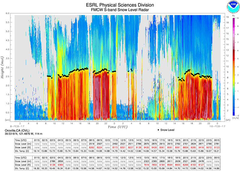
One parameter important in both hydrology and meteorology is the snow level— the level in the atmosphere where snow changes into rain. This is especially true in complex terrain, where spatial and temporal variations of the snow level make hydrologic forecasting difficult. NOAA ESRL Physical Sciences Division (PSD) scientists had shown starting in the early 2000's that their vertically pointing radars provide valuable information about the snow level by measuring the altitude of the radar bright band that results when frozen precipitation melts. However, PSD's existing wind profilers and precipitation profiling radars used for this purpose were too expensive to deploy at the density required to adequately monitor the snow level for a place like California. To address this problem, engineers from Cooperative Institute for Research in Environmental Sciences (CIRES) and PSD set out to construct a comparatively inexpensive vertically pointing S-band radar. The result of this development was a prototype frequency-modulated continuous-wave S-band radar (a.k.a. snow-level radar, SLR) that cost about 1/5th of the price of one of PSD's other radars traditionally used for this purpose. In an article published in the February issue of the Journal of Atmospheric and Oceanic Technology, CIRES and PSD authors provide the background and a technical description of this innovative radar.
With funding provided by the California Department of Water Resources (CA-DWF), PSD constructed ten SRLs and deployed them in major watersheds across the state where snow level information would be critical—including the Lake Oroville watershed that has been in the news recently. Data from the radars are transmitted to PSD via cellular modems or satellite, and data images are displayed online in near real-time. Data are also transmitted to NWS forecast offices in California using the Standard Hydrologic Exchange Format (SHEF) that is compatible with the hydrologic data based used in the River Forecast Centers.
Johnston, P., J. Jordan, A. White, D. Carter, D. Costa, and T. Ayers: The NOAA FM-CW Snow-Level Radar. J. Atmos. Oceanic Technol., 34, 249–267, doi:10.1175/JTECH-D-16-0063.1.
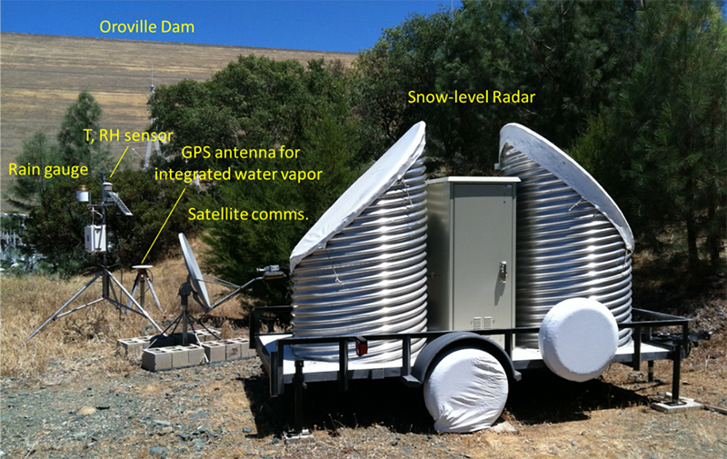
The Snow-level Radar and other meteorological monitoring equipment in Oroville, California.
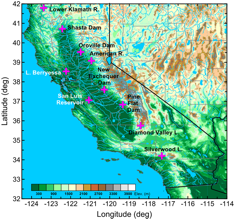
The locations of the ten snow-level radars deployed in major watersheds across California that are supported by the CA-DWR.